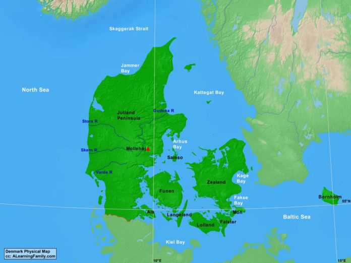
The Denmark physical map is provided. The physical map includes a list of major landforms and bodies of water of Denmark.
A student may use the blank Denmark outline map to practice locating these physical features.
Features of the Denmark Physical Map
Bodies of Water
- Arhus Bay
- Baltic Sea
- Fakse Bay
- Jammer Bay
- Kage Bay
- Kattegat Bay
- Kiel Bay
- North Sea
- Skaggerak Strait
Major Landforms
- Als
- Bornholm
- Falster
- Funen
- Gudena River
- Jutland Peninsula
- Langeland
- Lolland
- Mollehoj
- Mon
- Samso
- Skern River
- Stora River
- Varde River
- Zealand

