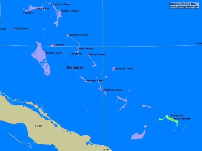
The Bahamas political map is provided. The political map includes a list of neighboring countries and major cities of the Bahamas.
A student may use the blank Bahamas outline map to practice locating these political features.
Features of the Bahamas Political Map
Neighboring Countries
- Cuba
- Turks and Caicos Islands
Major Cities
- Nassau (capital)
- Alice Town
- Andros Town
- Arthur’s Town
- Clarence Town
- Cockburn Town
- Coopers Town
- Dunmore Town
- Freeport
- Freetown
- George Town
- Highrock
- Marsh Harbour
- Rock Sound

